Geocoding Options
|
Parameter |
Description |
|---|---|
|
SearchDistance |
The radius from the input coordinates in which to search for an address. Street segments and points within the radius are considered. The default search radius is 150 meters and the maximum search radius is 1600 meters. |
|
Units |
The units in which the search distance is specified. One of the following:
|
|
OffsetFromStreet |
Indicates the offset distance from the street segments to use in street-level geocoding. The distance is specified in the units you specify in the OffsetUnits option. The default value varies by country. For most countries, the default is 7 meters. The offset distance is used in street-level geocoding to prevent the geocode from being in the middle of a street. It compensates for the fact that street-level geocoding returns a latitude and longitude point in the center of the street where the address is located. Since the building represented by an address is not on the street itself, you do not want the geocode for an address to be a point on the street. Instead, you want the geocode to represent the location of the building which sits next to the street. For example, an offset of 40 feet means that the geocode will represent a point 40 feet back from the center of the street. The distance is calculated perpendicular to the portion of the street segment for the address. Offset is also used to prevent addresses across the street from each other from being given the same point. The diagram below shows an offset point in relation to the original point. 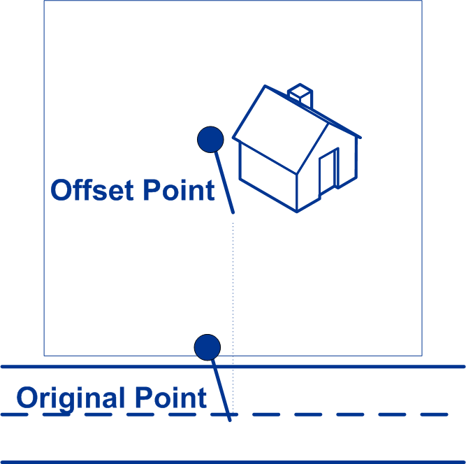 Street coordinates are accurate to 1/10,000 of a degree and interpolated points are accurate to the millionths of a degree. |
|
OffsetFromCorner |
Specifies the distance to offset the street end points in street-level matching. The distance is specified in the units you specify in the OffsetUnits option.This value is used to prevent addresses at street corners from being given the same geocode as the intersection. Note: Offset is not supported
for the United Kingdom (GBR) or Japan (JPN).
The default value varies by country:
The following diagram compares the end points of a street to offset end points. 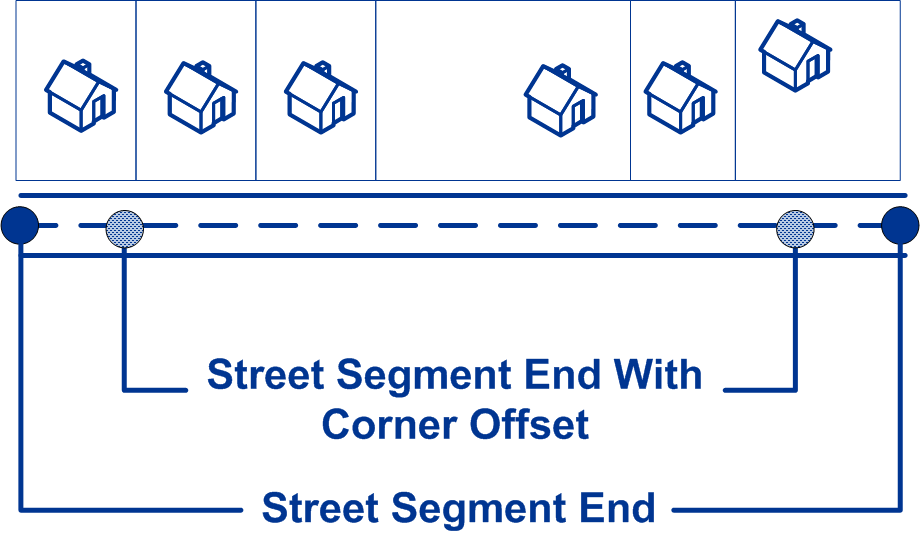
|
|
OffsetUnits |
Specifies the unit of measurement for the street offset and corner offset options. One of the following:
The default is Meters. |
|
CoordinateSystem |
A coordinate system is a reference system for the unique location of a point in space. Cartesian (planar) and Geodetic (geographical) coordinates are examples of reference systems based on Euclidean geometry. Spectrum™ Technology Platform supports systems recognized by the European Petroleum Survey Group (EPSG). Each country supports different coordinate systems. Depending on the country, you have one or more of the following options:
|