Using Geocoding
The Geocoding feature enables you to manually geocode the entities in your model by using a service that performs geocoding. If you have already defined geocoding options, simply click the top half of the Geocode button from the Geocoding ribbon on the Data tab to perform geocoding.
If you have not already defined geocoding options, click the bottom half of the Geocode button and follow these steps:
- Select a service that performs geocoding from the
Geocoding service dropdown.
If the service you select contains latitude and longitude fields, the Geocoding feature will automatically detect those fields and populate the Entity Property column. If the service performs geocoding but the latitude and longitude data is in other fields, you will need to map those fields in the Entity Property column:
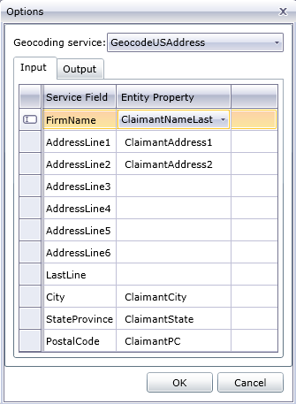
If you select a service that does not perform geocoding, an error message will appear, saying "Service does not appear to geocode."
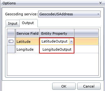
- If you want to change the name of the latitude and
longitude fields when geocoding is performed, click
the Output tab and change the
names in the Entity Property
column:
- Click OK. The Relationship
Analysis Client will perform geocoding and add latitude and longitude data to your
model:
