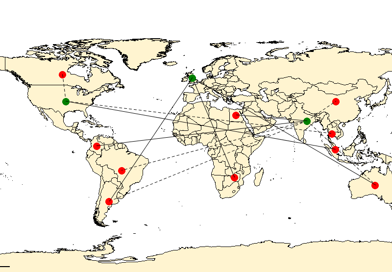
Line Linkage Layer
Maps using line linkages enable you to examine the relationship between points by connecting them with a line based on a common variable between them. A good example of a line linkage map is to display the flights in and out of airports and show the connections between each airport. These linkage maps represent the lines drawn on the map from a source geometry (centroid) to a destination geometry (centroid) based on a relationship expression/column.

You can customize the color of each point as well as the lines connecting each point. To style the point, a simple style can be applied. To style the line, a metric theme can be applied to group values. The layer allows for one style for start points, one style for end points, and zero or more modifiers for the line styles.
There are various ways to create line linkage maps; using a named layer, using a named map with an overlay using named tables, using an inline defined line linkage in a map. However, they all have the same basic structure. All linkage maps require two tables, a geometry and a linkage table. And all linkage maps need to define the relationship, metric, source, and destination expressions.
The geometry table contains two important columns; a relationship and a geometry column. The relationship column is the column that contains the records that will be linked to the records in the source and destination columns in the linkage table. The values in the columns need to be the same. The geometry column is the column that contains the geometries to render the points for both the source and destination columns. The linkage table contains three important columns: a source, a destination, and a metric column. The source column is the starting location for a linkage, while the destination column is the end location for a linkage. These two columns must contain the same type of information as the relationship column in the geometry table. The metric column defines the actual linkage between the two points, and contains values that represent the line. This column is used to add themes or stylize the line. For example, the metric column might contain values of the number of flights between two cities. In this case you may want to make the connecting line thicker/thinner or styled differently depending on the number of flights.
- Embedded inline in a named map
- As a named layer
- In a SOAP request as an overlay
- In a REST request as an overlay with an in-memory table.