| diagram |
 |
| namespace |
http://www.mapinfo.com/midev/service/mapping/v1 |
| type |
tns:GetMapZoomLevelRequest |
| properties |
|
| children |
tns:MapView |
| attributes |
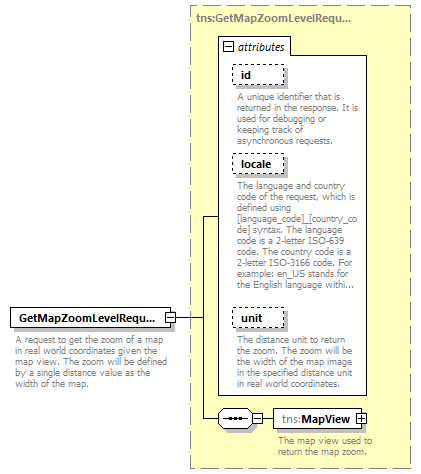
| Name | Type | Use | Default | Fixed | Annotation | | id | xsd:string | optional | | | | documentation | | A unique identifier that is returned in the response. It is used for debugging or keeping track of asynchronous requests. |
| | locale | xsd:string | optional | | | | documentation | | The language and country code of the request, which is defined using [language_code]_[country_code] syntax. The language code is a 2-letter ISO-639 code. The country code is a 2-letter ISO-3166 code. For example: en_US stands for the English language within the United States of America. |
| | unit | tns:DistanceUnit | optional | | | | documentation | | The distance unit to return the zoom. The zoom will be the width of the map image in the specified distance unit in real world coordinates. |
|
|
| annotation |
| documentation | | A request to get the zoom of a map in real world coordinates given the map view. The zoom will be defined by a single distance value as the width of the map. |
|