Street Matching
Street matching identifies the approximate location of an address on a street segment. In street matching, the location is determined by calculating the approximate location of a house number based on the range of numbers in the location's street. For example, if the address is on a street segment with a range of addresses from 50 to 99, then it is assumed that the house number 75 would be in the middle of the street segment. This method assumes that the addresses are evenly spaced along the street segment. As a result, it is not as exact as point matching since addresses may not be evenly distributed along a street segment.
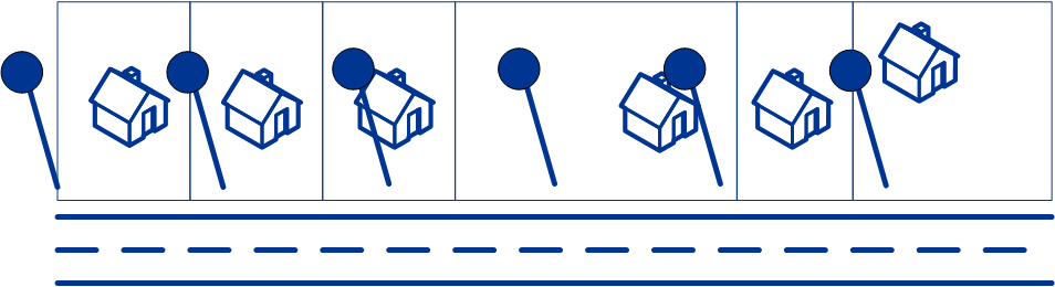
For example, the following diagram shows the results of street-level matching along a segment with unevenly-spaced buildings. The first three buildings are fairly accurately geocoded because they are evenly spaced. The fourth building, however, resides on a slightly larger parcel than the others along this street. Since street-level matching assumes that the buildings are evenly spaced, the result is that fourth, fifth, and sixth houses are not as precise as the first three. If you were to use point-level geocoding, the results would be more accurate.