Using Geocoding
Perform this procedure to define geocoding options.
- In the Geocoding service box, select a service that performs geocoding.
If the service you select contains latitude and longitude fields, the Geocoding feature will automatically detect those fields and populate the Entity Property column. If the service performs geocoding but the latitude and longitude data is in other fields, you will need to map those fields in the Entity Property column:
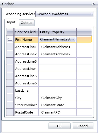
If you select a service that does not perform geocoding, an error message displays Service does not appear to geocode.
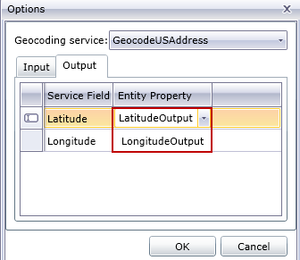
- To change the name of the latitude and longitude fields when geocoding is performed, click the Output tab and change the names in the Entity Property column.
- Click OK.
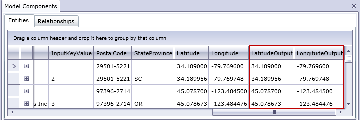
The Relationship Analysis Client will perform geocoding and add latitude and longitude data to your model.