| diagram |
 |
| namespace |
http://www.mapinfo.com/midev/service/geometry/v1 |
| type |
extension of tns:GeometryServiceRequest |
| properties |
| base | tns:GeometryServiceRequest |
|
| used by |
|
| attributes |
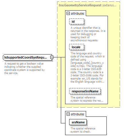
| Name | Type | Use | Default | Fixed | Annotation | | id | xsd:string | optional | | | | documentation | | A unique identifier that is returned in the response. It is used for debugging or keeping track of asynchronous requests. |
| | locale | xsd:string | optional | | | | documentation | | The language and country code of the request, which is defined using [language_code]_[country_code] syntax. The language code is a 2-letter ISO-639 code. The country code is a 2-letter ISO-3166 code. For example: en_US stands for the English language within the United States of America. |
| | responseSrsName | xsd:string | optional | | | | documentation | | The spatial reference system to express the response in. |
| | srsName | xsd:string | required | | | | documentation | | The spatial reference system to check. |
|
|
| annotation |
| documentation | | A request to get a boolean value indicating whether the supplied coordinate system is supported by the service. |
|