| diagram |
 |
| namespace |
http://www.mapinfo.com/midev/service/featurecollection/v1 |
| type |
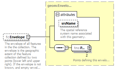
tns:Envelope |
| properties |
| minOcc | 0 | | maxOcc | 1 | | content | complex |
|
| children |
tns:Pos |
| attributes |
| Name | Type | Use | Default | Fixed | Annotation | | srsName | xsd:string | optional | | | | documentation | | The spatial reference system name associated with this geometry. |
|
|
| annotation |
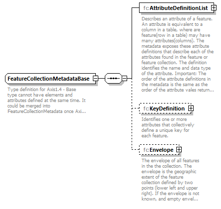
| documentation | | The envelope of all features in the the collection. The envelope is the geographic extent of the feature collection defined by two points (lower left and upper right). If the envelope is not known, and empty envelope will be returned. |
|