|
Name
|
Type
|
Use
|
Default
|
Fixed
|
Annotation
|
|
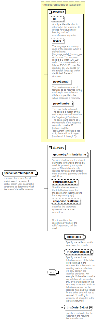
id
|
xsd:string
|
optional
|
|
|
|
|
A unique identifier that is returned in the response. It is used for debugging or keeping track of asynchronous requests.
|
|
|
locale
|
xsd:string
|
optional
|
|
|
|
|
The language and country code of the request, which is defined using [language_code]_[country_code] syntax. The language code is a 2-letter ISO-639 code. The country code is a 2-letter ISO-3166 code. For example: en_US stands for the English language within the United States of America.
|
|
|
pageLength
|
xsd:int
|
optional
|
|
|
|
|
The maximum number of features to be returned in the resulting feature collection. If this is not specified, the whole response is returned.
|
|
|
pageNumber
|
xsd:int
|
optional
|
1
|
|
|
|
The page to be returned. The page is a subset of the entire response and based on the 'pageLength' attribute. The page count begins at 1. For example, if the response normally contains 35 features and the 'pageLength' attribute is set to 8, there will be 5 pages (numbered 1 through 5).
|
|
|
geometryAttributeName
|
xsd:string
|
optional
|
|
|
|
|
Specify which geometry attribute definitions in the table should be used for processing the spatial query. This attribute is only required for tables that contain more than one geometry attribute definitions.
|
|
|
returnTotalCount
|
xsd:boolean
|
optional
|
false
|
|
|
|
Specify whether to return the total feature count for the search (not just the count for a requested page).
|
|
|
responseSrsName
|
xsd:string
|
optional
|
|
|
|
Specifies the coordinate system of the returned geometry.
If not specified, the coordinate system of the table's geometry will be used.
|
|