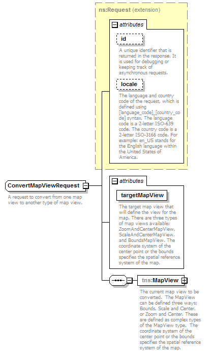
complexType ConvertMapViewRequest
diagram mapping_p93.png
namespace http://www.mapinfo.com/midev/service/mapping/v1
type extension of tns:Request
properties
base   ns:Request
children tns:MapView
used by
element   ConvertMapViewRequest
attributes
Name    Type    Use    Default    Fixed    Annotation
id    xsd:string    optional         
A unique identifier that is returned in the response. It is used for debugging or keeping track of asynchronous requests.
locale    xsd:string    optional         
The language and country code of the request, which is defined using [language_code]_[country_code] syntax. The language code is a 2-letter ISO-639 code. The country code is a 2-letter ISO-3166 code. For example: en_US stands for the English language within the United States of America.
targetMapView    tns:MapViewName    required         
The target map view that will define the view for the map. There are three types of map views available: ZoomAndCenterMapView, ScaleAndCenterMapView, and BoundsMapView. The coordinate system of the center point or the bounds specifies the spatial reference system of the map.
description
A request to convert from one map view to another type of map view.

attribute ConvertMapViewRequest/@targetMapView
type tns:MapViewName
properties
use   required
facets
Kind   Value   Annotation
enumeration   ZoomAndCenterMapView
A map view that uses a zoom and center value.
enumeration   ScaleAndCenterMapView
A map view that uses a scale and center value.
enumeration   BoundsMapView
A map view that uses a bounds value.
description
The target map view that will define the view for the map. There are three types of map views available: ZoomAndCenterMapView, ScaleAndCenterMapView, and BoundsMapView. The coordinate system of the center point or the bounds specifies the spatial reference system of the map.

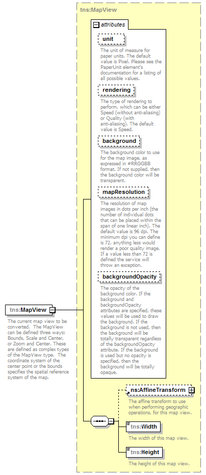
element ConvertMapViewRequest/MapView
diagram mapping_p94.png
namespace http://www.mapinfo.com/midev/service/mapping/v1
type tns:MapView
properties
content   complex
children tns:AffineTransform tns:Width tns:Height
attributes
Name    Type    Use    Default    Fixed    Annotation
unit    tns:PaperUnit    optional    Pixel      
The unit of measure for paper units. The default value is Pixel. Please see the PaperUnit element's documentation for a listing of all possible values.
rendering    tns:Rendering    optional    Speed      
The type of rendering to perform, which can be either Speed (without anti-aliasing) or Quality (with anti-aliasing). The default value is Speed.
background    xsd:string    optional         
The background color to use for the map image, as expressed in #RRGGBB format. If not supplied, then the background color will be transparent.
mapResolution    xsd:int    optional         
The resolution of map images in dots per inch (the number of individual dots that can be placed within the span of one linear inch). The default value is 96 dpi. The minimum dpi you can define is 72, anything less would render a poor quality image. If a value less than 72 is defined the service will throw an exception.
backgroundOpacity    xsd:double    optional         
The opacity of the background color. If the background and backgroundOpacity attributes are specified, these values will be used to draw the background. If the background is not used, then the background will be totally transparent regardless of the backgroundOpacity attribute. If the background is used but no opacity is specified, then the background will be totally opaque.
description
The current map view to be converted.  The MapView can be defined three ways: Bounds, Scale and Center, or Zoom and Center. These are defined as complex types of the MapView type.  The coordinate system of the center point or the bounds specifies the spatial reference system of the map.


© 2016 Pitney Bowes Software Inc. Email: pbbi.support@pb.com