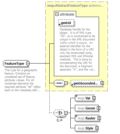
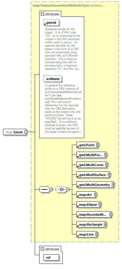
complexType FeatureType
diagram mws_p797.png
namespace http://www.mapinfo.com/mxp
type extension of mxp:AbstractFeatureType
properties
base mxp:AbstractFeatureType
children gml:boundedBy mxp:Val mxp:Geom mxp:Raster mxp:Style
used by
element Feature
attributes
Name  Type  Use  Default  Fixed  Annotation
gml:id  xs:ID  optional      
documentation
Database handle for the object.  It is of XML type "ID", so is constrained to be unique in the XML document within which it occurs.  An external identifier for the object in the form of a URI may be constructed using standard XML and XPointer methods.  This is done by concatenating the URI for the document, a fragment separator "#", and the value of the id attribute. 
annotation
documentation
The type for a geographic feature. Contains an unordered set of feature attribute values. For all contained elements the required attribute "ref" refers back to the metadata definition for that attribute.

element FeatureType/Val
diagram mws_p798.png
namespace http://www.mapinfo.com/mxp
type extension of xs:string
properties
content complex
attributes
Name  Type  Use  Default  Fixed  Annotation
ref  xs:IDREF  required      

attribute FeatureType/Val/@ref
type xs:IDREF
properties
use required

element FeatureType/Geom
diagram mws_p799.png
namespace http://www.mapinfo.com/mxp
type extension of mxp:FeatureGeometryAttributeType
properties
content complex
children gml:Point gml:MultiPoint gml:MultiCurve gml:MultiSurface gml:MultiGeometry mxp:Arc mxp:Ellipse mxp:RoundedRect mxp:Rectangle mxp:Line
attributes
Name  Type  Use  Default  Fixed  Annotation
gml:id  xs:ID  optional      
documentation
Database handle for the object.  It is of XML type "ID", so is constrained to be unique in the XML document within which it occurs.  An external identifier for the object in the form of a URI may be constructed using standard XML and XPointer methods.  This is done by concatenating the URI for the document, a fragment separator "#", and the value of the id attribute. 
srsName  xs:anyURI  optional      
documentation
In general this reference points to a CRS instance of gml:CoordinateReferenceSystemType (see coordinateReferenceSystems.xsd). For well known references it is not required that the CRS description exists at the location the URI points to (Note: These "WKCRS"-ids still have to be specified).  If no srsName attribute is given, the CRS must be specified as part of the larger context this geometry element is part of, e.g. a geometric aggregate.
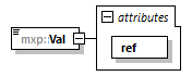
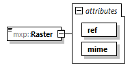
ref  xs:IDREF  required      

attribute FeatureType/Geom/@ref
type xs:IDREF
properties
use required

element FeatureType/Raster
diagram mws_p800.png
namespace http://www.mapinfo.com/mxp
type extension of xs:base64Binary
properties
content complex
attributes
Name  Type  Use  Default  Fixed  Annotation
ref  xs:IDREF  required      
mime  mxp:RasterMIMEType  required      

attribute FeatureType/Raster/@ref
type xs:IDREF
properties
use required

attribute FeatureType/Raster/@mime
type mxp:RasterMIMEType
properties
use required

element FeatureType/Style
diagram mws_p801.png
namespace http://www.mapinfo.com/mxp
properties
content complex
children mxp:_Style
attributes
Name  Type  Use  Default  Fixed  Annotation
ref  xs:IDREF  required      

attribute FeatureType/Style/@ref
type xs:IDREF
properties
use required


© 2019 Pitney Bowes Software Inc. support.pb.com