| diagram |
 |
| namespace |
http://www.mapinfo.com/midev/service/geometries/v1 |
| type |
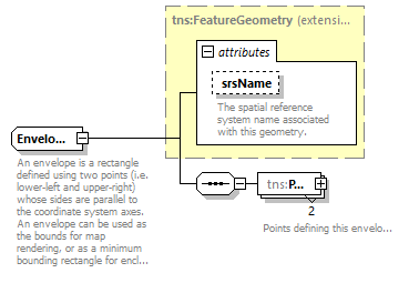
extension of tns:FeatureGeometry |
| properties |
|
| children |
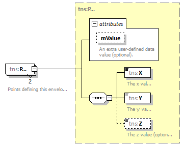
tns:Pos |
| used by |
|
| attributes |
| Name | Type | Use | Default | Fixed | Annotation | | srsName | xsd:string | optional | | | | documentation | | The spatial reference system name associated with this geometry. |
|
|
| annotation |
| documentation | | An envelope is a rectangle defined using two points (i.e. lower-left and upper-right) whose sides are parallel to the coordinate system axes. An envelope can be used as the bounds for map rendering, or as a minimum bounding rectangle for enclosing a geometry. |
|