| Name | Type | Use | Default | Fixed | Annotation |
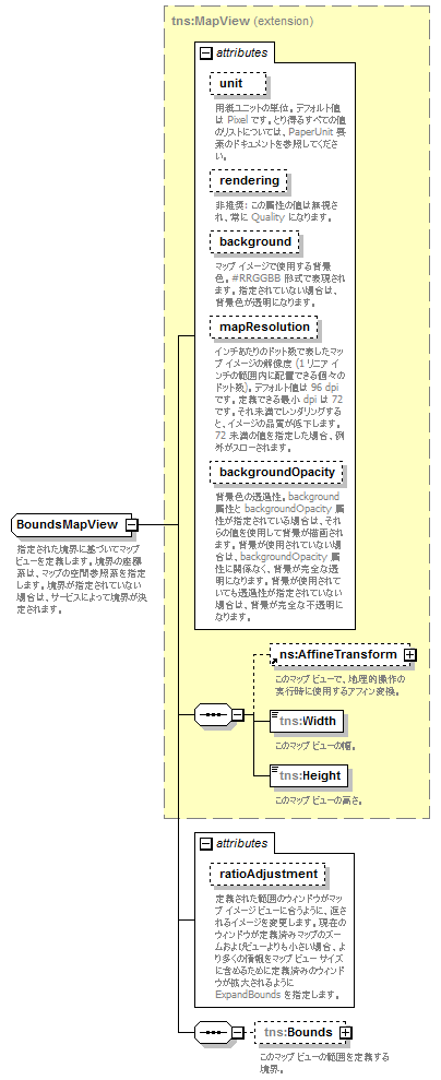
| unit | tns:PaperUnit | optional | Pixel | | | documentation | | 用紙ユニットの単位。デフォルト値は Pixel です。とり得るすべての値のリストについては、PaperUnit 要素のドキュメントを参照してください。 |
|
| rendering | tns:Rendering | optional | Speed | | | appinfo | | 非推奨 | | documentation | | 非推奨: この属性の値は無視され、常に Quality になります。 |
|
| background | xsd:string | optional | | | | documentation | | マップ イメージで使用する背景色。#RRGGBB 形式で表現されます。指定されていない場合は、背景色が透明になります。 |
|
| mapResolution | xsd:int | optional | | | | documentation | | インチあたりのドット数で表したマップ イメージの解像度 (1 リニア インチの範囲内に配置できる個々のドット数)。デフォルト値は 96 dpi です。定義できる最小 dpi は 72 です。それ未満でレンダリングすると、イメージの品質が低下します。72 未満の値を指定した場合、例外がスローされます。 |
|
| backgroundOpacity | xsd:double | optional | | | | documentation | | 背景色の透過性。background 属性と backgroundOpacity 属性が指定されている場合は、それらの値を使用して背景が描画されます。背景が使用されていない場合は、backgroundOpacity 属性に関係なく、背景が完全な透明になります。背景が使用されていても透過性が指定されていない場合は、背景が完全な不透明になります。 |
|
| ratioAdjustment | tns:RatioAdjustment | optional | ExpandBounds | | | documentation | | 定義された範囲のウィンドウがマップ イメージ ビューに合うように、返されるイメージを変更します。現在のウィンドウが定義済みマップのズームおよびビューよりも小さい場合、より多くの情報をマップ ビュー サイズに含めるために定義済みのウィンドウが拡大されるように ExpandBounds を指定します。 |
|